Up to 2 cm*

40 m @ 10% reflectivity

360° × 59°

200,000

1 kg / 2.2 lbs

Visualize as you scan
Easy Reality Capture
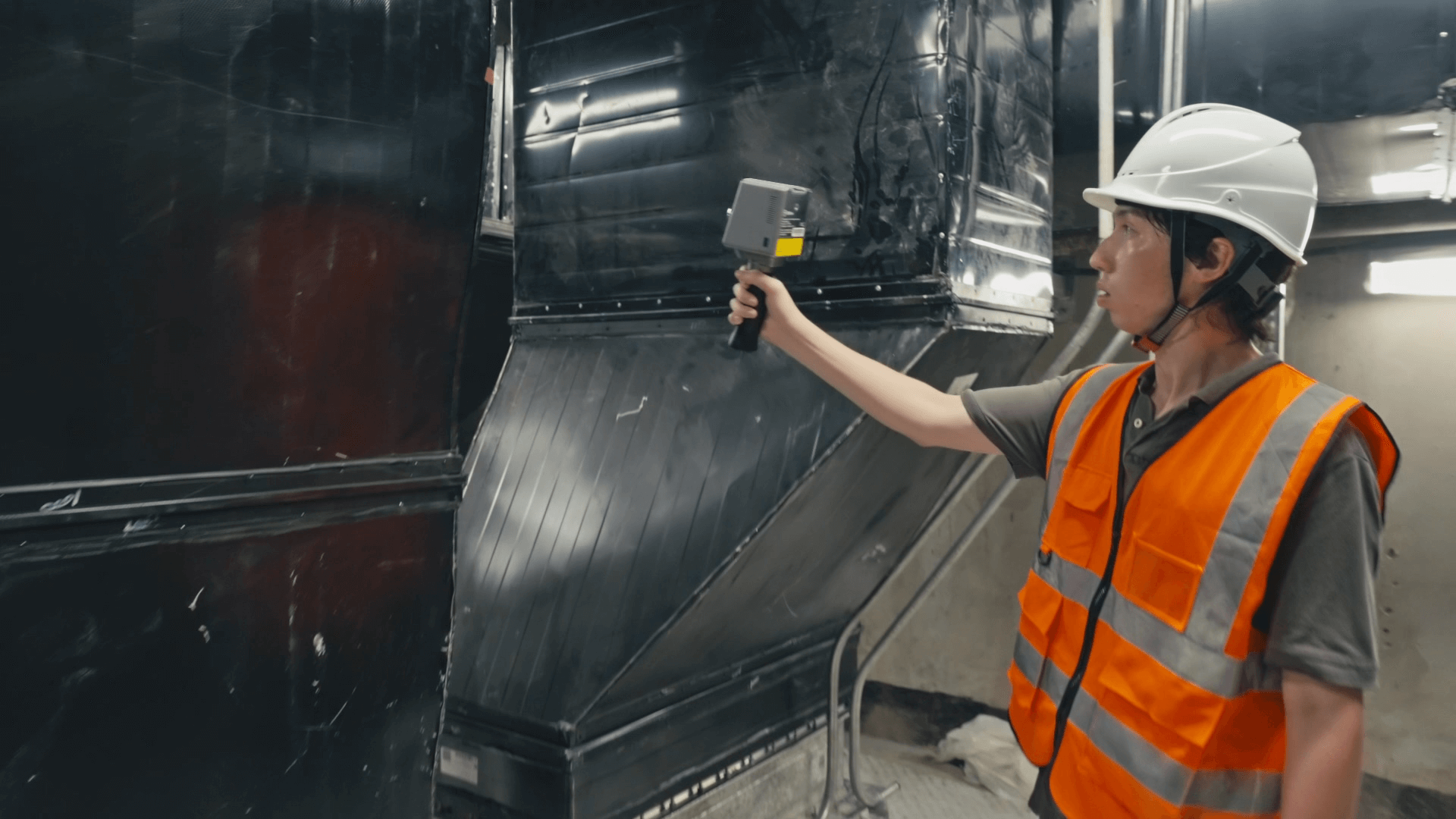
Whether you are a seasoned laser scanning professional or just 3D-curious, a walk around the site with the P1 lets you digitize your environment quickly and accurately.
Key Benefits
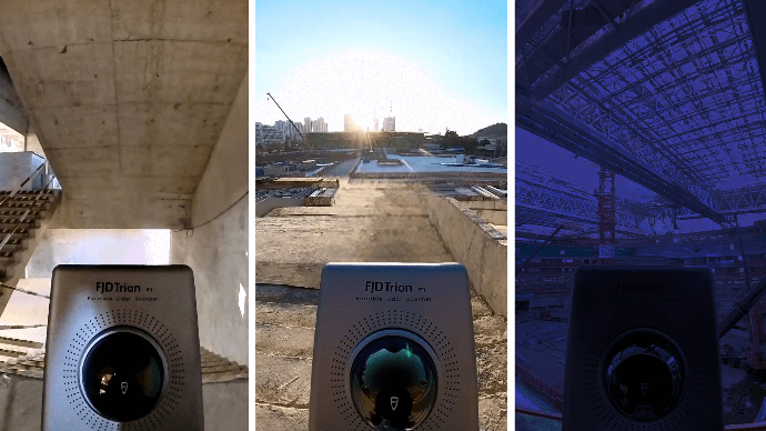
Indoor, Outdoor, Underground,
all Day Long
Wherever you go, the P1 can capture what you see. Map the environment with intricate details inside and outside, from ornate architecture to hidden infrastructure, from forensic evidence to urban vegetation analysis. Powerful SLAM technology enables the P1 to work in direct sunlight or even at night, in locations that may be inaccessible with traditional methods.

Compact Yet Mighty
Pick up the FJD Trion P1 whenever you want to take a closer look at your world. Weighing in at only 1 kg or slightly over 2 lbs, the P1 fits in a messenger bag and can work all day with easy battery swaps, recreating your environment in minutes.

Complete Point Cloud Solution
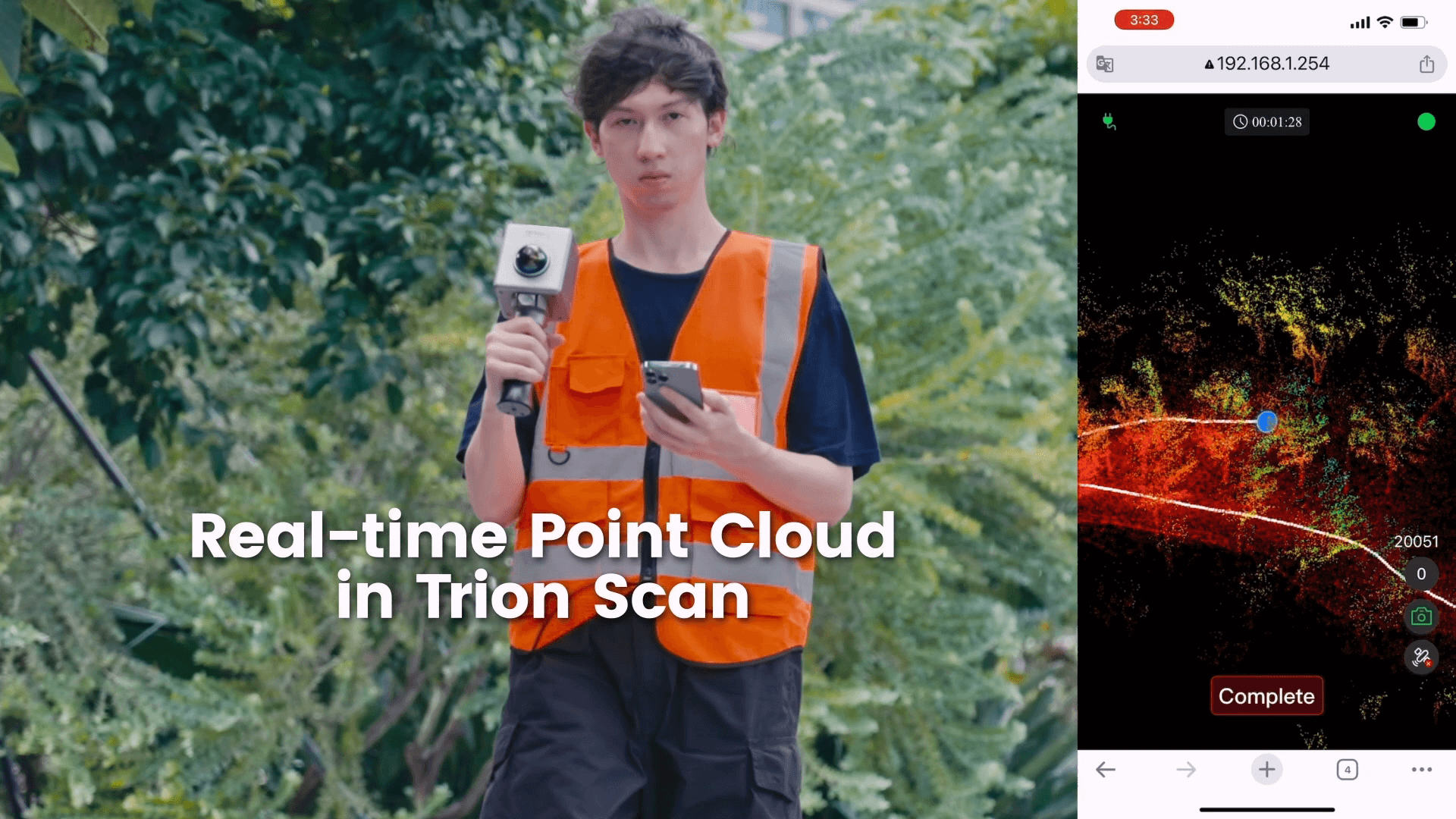
FJD Trion Scan
Real-time point cloud visualization software
Enhance your scanning experience with the FJD Trion Scan software. This real-time visualization tool can help you monitor the scanning process thus ensure a complete data capture in one scan.
![]()
![]()
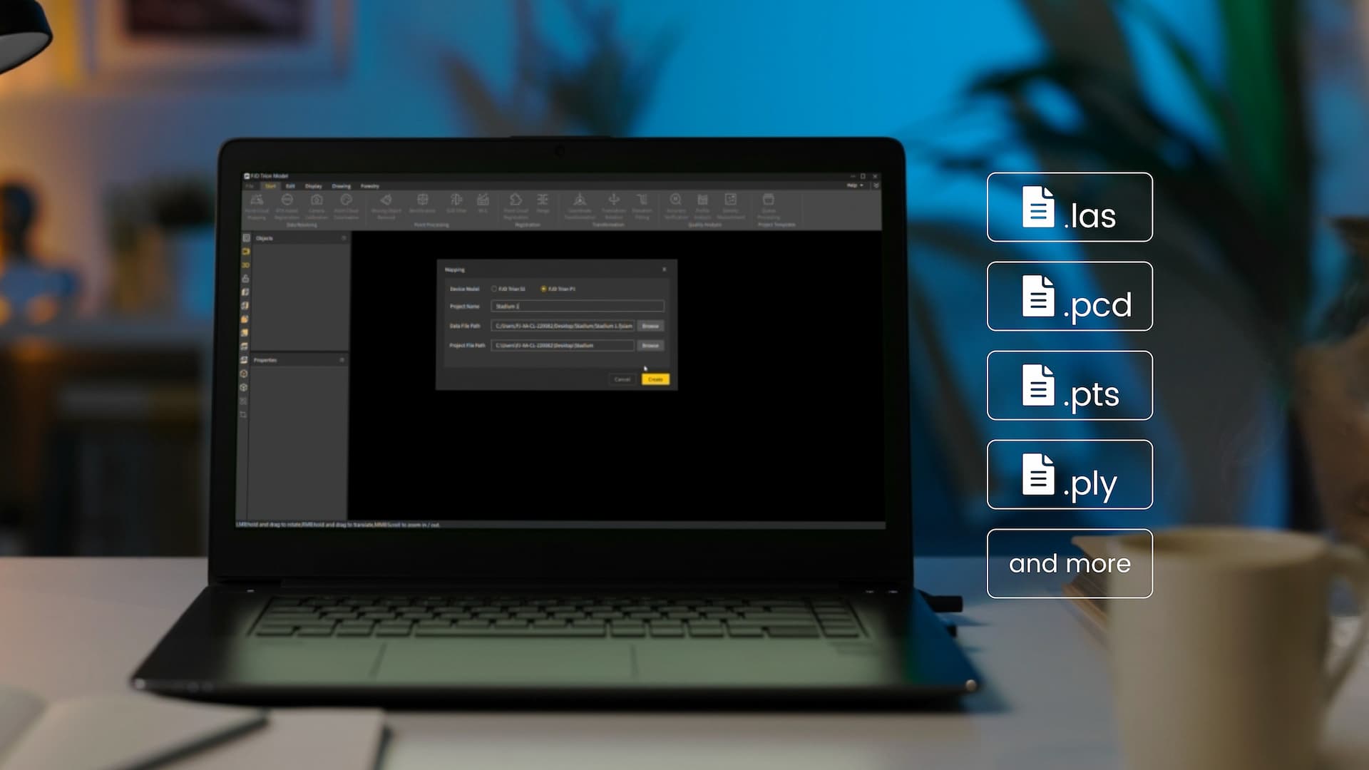
FJD Trion Model
Point cloud processing software
FJD Trion Model is a PC-based point cloud processing solution that enables denoising, colorization, and classification. Industry-specific modules empower quick and seamless results for like floor plan generation for construction, volume calculation for tunnels, and tree segmentation for forestry.
Free Trial
Download
Free Trial
Download
Application Scenarios

Property Management and Assessment
Assess structural integrity, plan spaces, and identify areas in need of repair or renovation. Reduce uncertainty in investment decisions with insights from a rich spatial dataset.

Public Safety
Leverage point cloud data to enhance disaster preparedness and recovery plans. Quickly record evidence and crime or accident scenes for immediate and accurate forensic documentation.

Architecture, Engineering and Construction
Make more informed decisions on your projects from blueprint to QA/QC with building surveys, scan to CAD&BIM, as-built documentation, floor plans, and stockpile volumes.

Media and Entertainment
Craft new realities based on real-world inspirations. Whether you're creating video games, virtual tours, or cinematic environments, capture the essence of both indoor and outdoor settings.

Forestry and Vegetation Analysis
Manage and monitor tree inventory with a quick walk in the forest. Measure crowns, analyze breast diameter and tree height using precise point cloud data.

Robotics
Facilitate communications between teams before and during robotics deployment. Plan routes and enhance robot obstacle avoidance with 2D maps and 3D models of the environment.